Risorsa 6
Home
IMMAs
IMMA Selection Criteria
IMMA Identification Process
IMMA definitions
FAQ on IMMAs
IMMA citations
Regional IMMA workshops
Mediterranean Sea
Pacific Islands
North East Indian Ocean and South East Asian Seas
Extended Southern Ocean
Western Indian Ocean and Arabian Seas
Australia-New Zealand and South East Indian Ocean
Black Sea, Turkish Straits System and Caspian Sea
South East Tropical and Temperate Pacific Ocean
South West Atlantic Ocean Region
North East Atlantic Ocean Region
North West Atlantic Ocean and Wider Caribbean
Current IMMAs Summary
IMMAs Searchable Database
IMMAs Description and Fact Sheets
IMMA Spatial Layer Download
Regional Groups
How can IMMAs be used?
IMMA e-Atlas
Task Force
Mission
Task Force Members
Supporting organisations
Partner organisations
Activities
Panorama Solutions
Geospatial Genetics to Identify IMMAs
Geospatial Analysis of Threats
ICMMPA
Resources
Documents
IMMA citations guidance
IMMA Spatial Layer Download
IMMA – Area Submission
Contacts
News
Menu
Menu
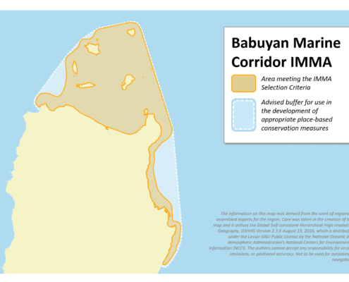
Babuyan Marine Corridor IMMA
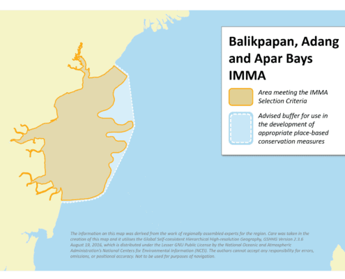
Balikpapan, Adang and Apar Bays IMMA
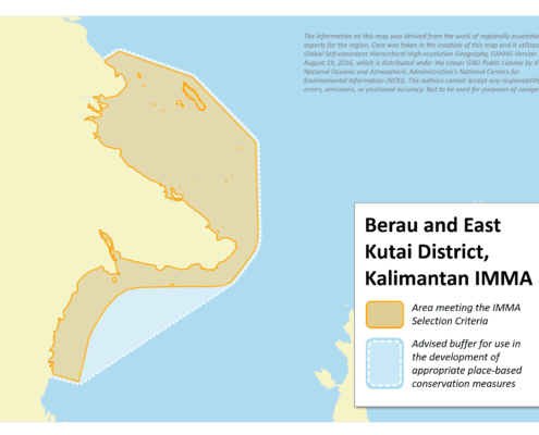
Berau and East Kutai District, Kalimantan IMMA
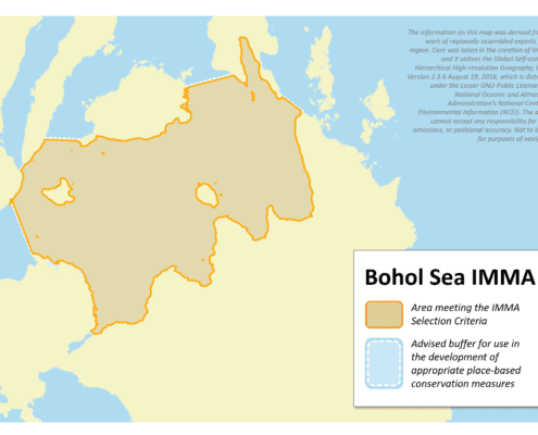
Bohol Sea IMMA
Bintuni Bay IMMA
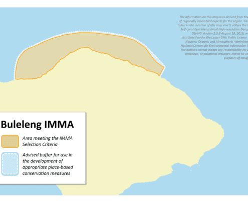
Buleleng IMMA
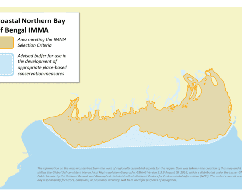
Coastal Northern Bay of Bengal IMMA
Con Dao IMMA
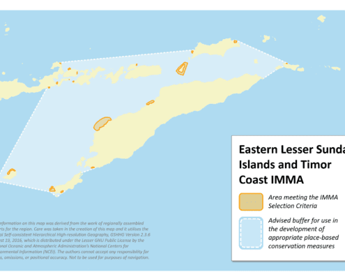
Eastern Lesser Sunda Islands and Timor Coastal Area IMMA
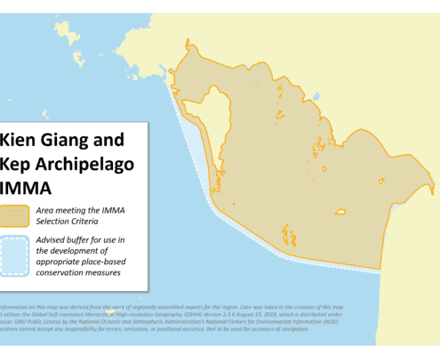
Kien Giang and Kep Archipelago IMMA
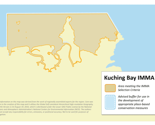
Kuching Bay IMMA
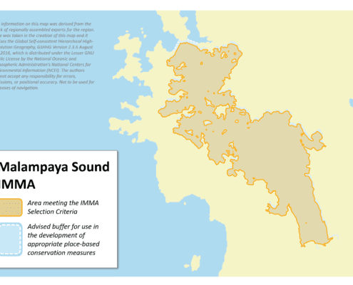
Malampaya Sound IMMA
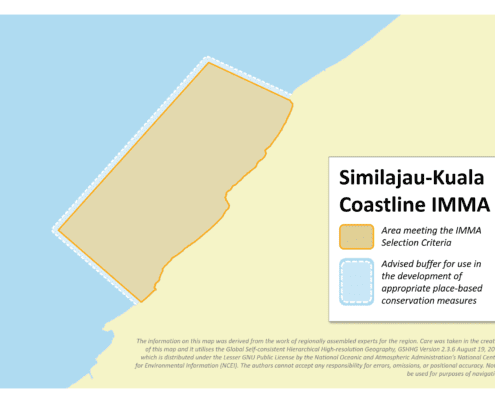
Similajau-Kuala Nyalau Coastline IMMA
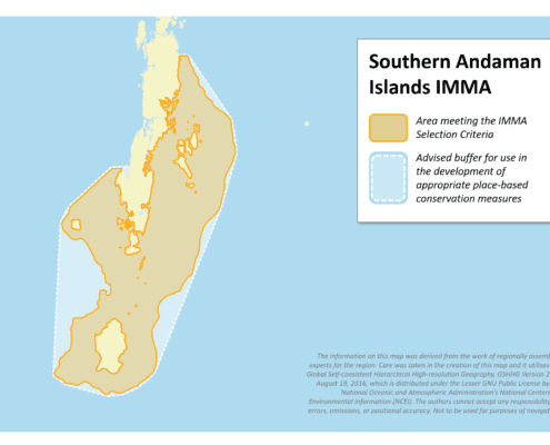
Southern Andaman Islands IMMA
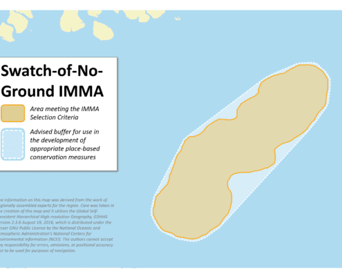
Swatch-of-No-Ground IMMA
Gulf of Mannar and Palk Bay IMMA
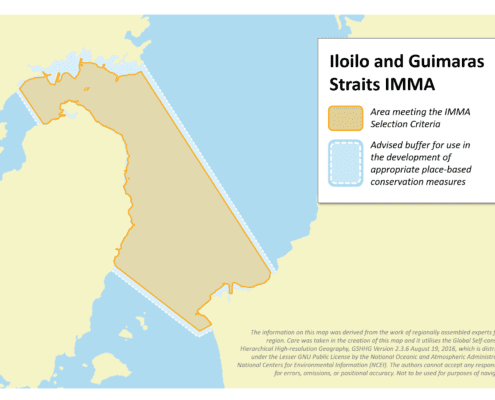
Iloilo and Guimaras Straits IMMA
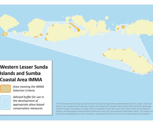
Western Lesser Sunda Islands and Sumba Coastal Area IMMA
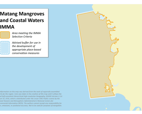
Matang Mangroves and Coastal Waters IMMA
Satun-Langkawi Archipelago IMMA
Page 1 of 2
1
2
Scroll to top
Loading...