Background and Motivation for the Project
In April 2019, the IUCN MMPA Task Force, the International Whaling Commission (IWC) and ACCOBAMS jointly hosted a workshop to evaluate how the data and process used to identify Important Marine Mammal Areas (IMMAs) can assist the IWC to systematically identify areas of high risk for ship strike, a key goal of the Commission’s Strategic Plan for addressing this issue. The workshop report generated a number of recommendations, including the following: ‘the IWC working with the IUCN MMPA Task Force and the CMS and its daughter agreements, undertake an initial analysis of global IMMAs, overlaid with shipping data, to identify potential high risk areas….’. WWF saw an opportunity to contribute to the implementation of this recommendation, through collaboration with its global Cetacean Initiative and the WWF Conservation Intelligence team (WWF SIGHT), and their subcontracted partner, Oceanmind.
Target audience
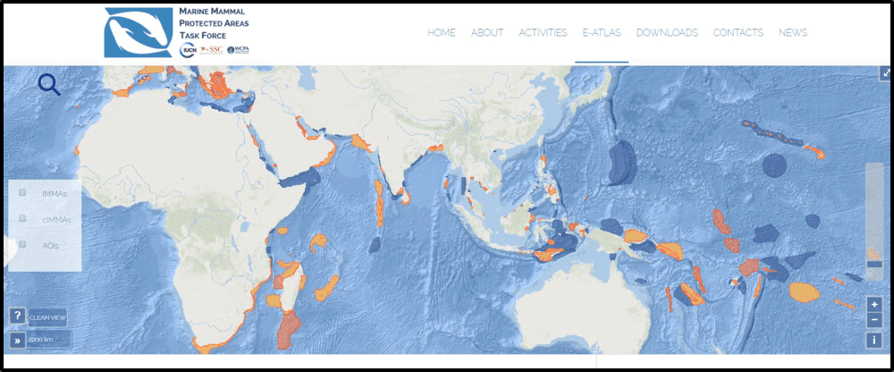
The full document is written in plain English, and comprises maps, tables and graphs depicting levels of vessel traffic in each of the 114 IMMAs identified as of September 2019. It is intended as a first step to assist NGOs, government, industry and any other stakeholders interested in management of the risks posed by vessel traffic in important marine mammal habitat with an assessment of areas that merit more in depth investigation and management measures.
Project Report
The project Report has three main components, which can be downloaded as one complete integrated document, or three separate PDF documents.
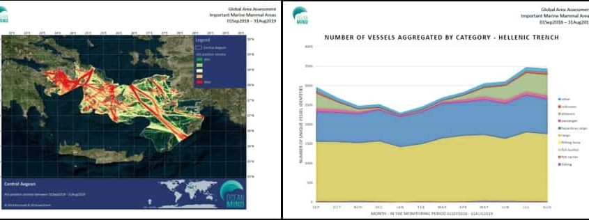
1: A report with a broad-scale analysis of shipping traffic in IMMAs using AIS data from 1 Sept 2018 to 31 Aug 2019. The report includes a master table with statistics of shipping traffic based on unique vessel identities in each of the 114 IMMAs identified as of September 2019. It also includes a table ranking the top 10 IMMAs in terms of risk for ship strike and cetacean bycatch based on the AIS data assessed. Finally, the report features detailed information for each of the 114 individual IMMAs identified as of September 2019, including:
- Tables and a graphs breaking down monthly densities of vessel traffic, per vessel category, based on unique vessels in each IMMA; and
- ‘Heat maps’ for each IMMA based on the density of AIS signals transmitted by all vessels in the specific IMMA over the course of the year.
2: A case study on the Mascarene Islands and associated oceanic features IMMA. This IMMA, that encompasses the Island of La Reunion and Mauritius, as well as their surrounding seas and features, was flagged in the analysis above as one of the top 10 risk areas for shipping and fishing impacts. The case study includes a more detailed analysis of the overlap of marine mammals and vessels, including a breakdown of the vessel categories and gear types for fishing vessels. Drawing on extensive cetacean distribution data collected by Globice and the Observatoire Pelagis aerial surveys, this case study examines patterns of vessel traffic and implicated fishing activity in relation to the (seasonal) distribution of humpback and sperm whales in the IMMA, and discusses the potential risk posed to these species, as well as the data gaps that need to be addressed in order to undertake a more robust risk analysis.
3: A case study on the Savu Sea and surrounding areas IMMA. The analysis of all 114 IMMAs also highlighted the Savu Sea IMMA as one of the top 10 risk areas for shipping and fisheries impacts. This case study uses a sparser dataset to examine the potential overlap between blue whale habitat use and vessel traffic, as well as small cetaceans and fishing vessels to identify potential high risk areas for ship strike and fisheries bycatch.
The final report can be downloaded in PDF format by clicking on the links below: